I got curious about cul-de-sacs after making a wrong turn into an unfamiliar subdivision and getting completely, totally lost. I kept making turns into dead ends, which raised the question: how the hell many of these godforsaken things are there, anyway?
To answer this question, I was worried I’d have to invest serious time into learning a GIS software, but the US Census conveniently has already identified most, if not all, of them already. (They’re listed here under Point Landmarks.)
I downloaded all the files and filtered for MTFCC 3061 (cul-de-sac) to get my answer: 582,679.
Most Cul-de-Sac-y ZIP Codes
Going a little deeper, I wanted to see where in the US cul-de-sacs are the most common. Simply plotting cul-de-sac points probably wouldn’t work–I assume we’d just get a population density map of the US. Instead, I decided to calculate the ratio of cul-de-sacs to the total number of roads in a given area.
I used R to map the cul-de-sac points onto a shapefile of ZIP codes to count how many there are per ZIP. This was free and much faster than reverse geocoding; even the cheapest bulk geocoder I found would still charge more than 2 grand to handle these nearly 600k records.
As for the number of roads per ZIP code, the US Census has provided an easy way to get a list. It’ll take a while to download all their county-level files via FTP (for me, about 4 hours), but with a little patience, WinZIP, and a database you can combine all the data into a full list of streets.
Finally, you can calculate the ratio of cul-de-sacs to the number of roads in a ZIP code. These were the top results for ZIPs with at least 50 roads:
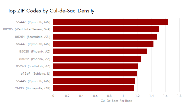
These results are kind of bonkers. 1.61 cul-de-sacs for every road?! At first, I doubted this could be right.
But looking into these ZIPs on GoogleMaps, many streets actually start and end in a cul-de-sacs, or branch into three or more dead-ends. The Plymouth, MN website even states the town has 920 cul-de-sacs and 320 miles of road, an astounding 2.8 cul-de-sacs per mile!
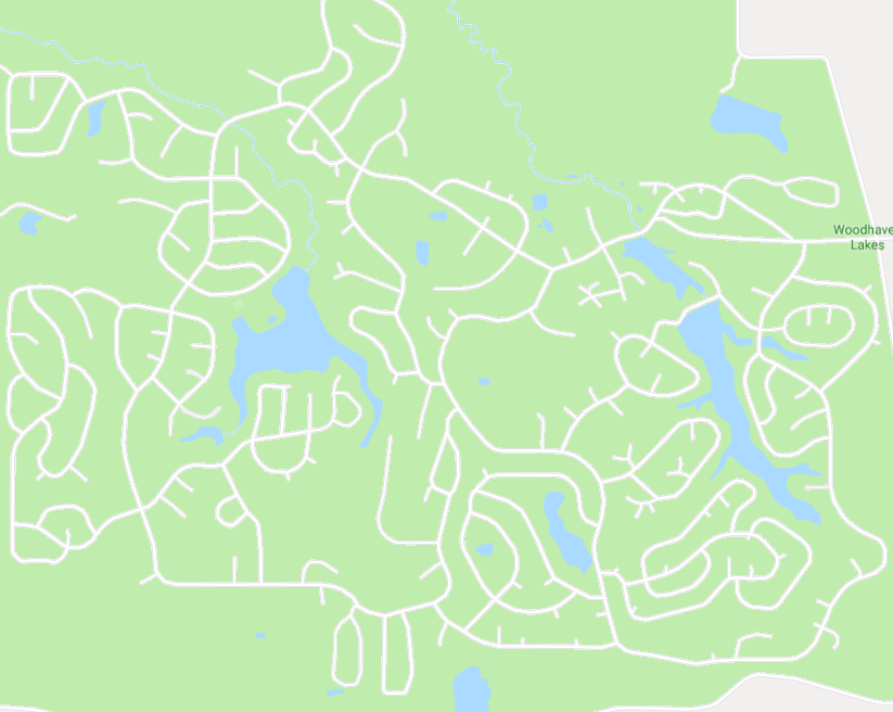
And just look at this campground in Sublette, IL:
Mappin’ it All Out
Now for the fun part: what does this all look like when mapped?
…With the color scheme I chose, it looks like ringworm! (click here for high-res)
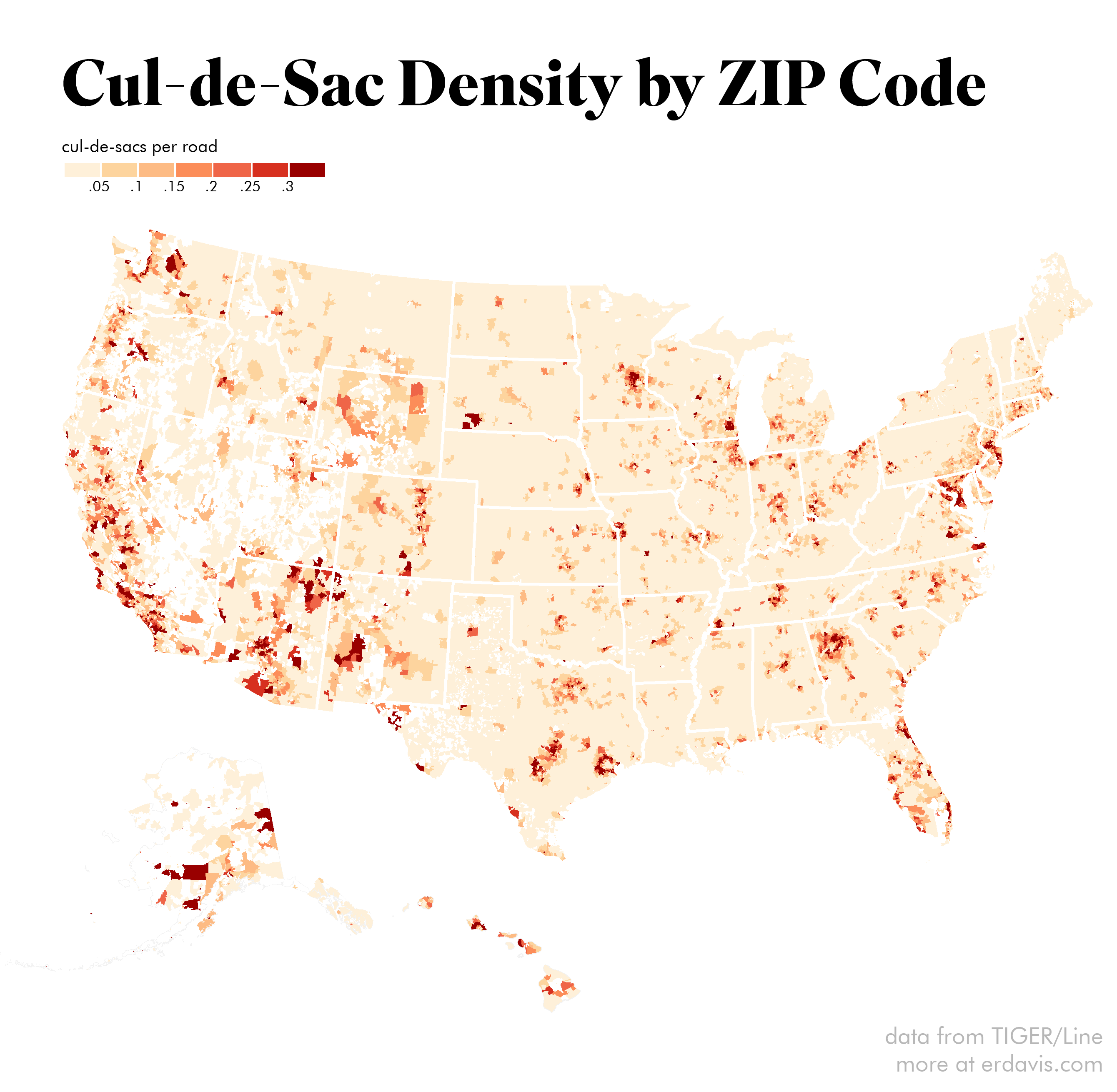
In the east and midwest, you can clearly see the propensity for building cul-de-sacs in the burbs but not the city center. This seems to break down in the west, especially in the southwest, where they just went hog-wild.
The coolest feature I noticed is how clearly the twin city centers of Dallas-Fort Worth stand out:

Discover more from Data Stuff
Subscribe to get the latest posts sent to your email.